Construction Aerial Data
Aerial Photos vs Progress Maps: What Construction Teams Actually Need
When someone says “we need drone work on the site,” they often mean one of two different deliverables. Mixing them up wastes money and creates the wrong expectation in the field.
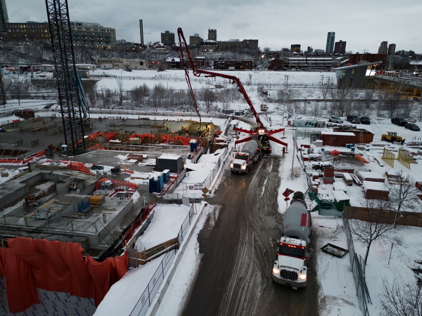
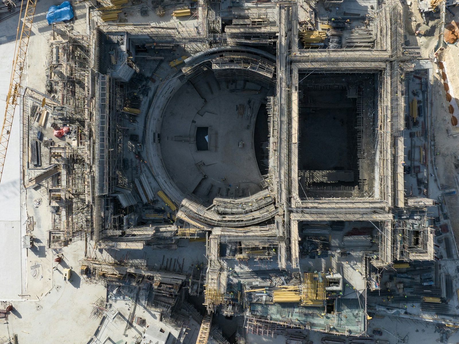
Left: illustrative oblique aerial photo (perspective / storytelling). Right: illustrative nadir aerial overview in an orthomosaic / progress-map style (flat, map-like framing for ops comparison). Neither image is a SkyForge client project or a licensed survey product.
Aerial photography (and video) is a communication tool
Still photos and video from the air are excellent for marketing, owner presentations, recruiting, and showing the “feel” of a project. Composition, lighting, and storytelling matter. The success metric is whether the image persuades or informs a human viewer—not whether two flights can be compared pixel-for-pixel a month apart.
Progress maps / site documentation are an operations tool
A progress map is high-resolution aerial site documentation you can reopen later and compare to the prior flight. For technical readers, that often means a georeferenced overview or orthomosaic—imagery aligned so teams can orient themselves and track change over time. The success metric is whether the superintendent, PM, and owner can share the same dated picture of what changed—and plan the next work window from it.
Why the difference matters on active jobs
Drive-bys and phone photos scatter. Marketing flights may look stunning and still leave the office arguing about pad status, stockpile movement, or how far utilities advanced since last month. Recurring progress documentation is built for that ops conversation: consistent altitude and overlap ideas, repeatable framing of the site, and deliverables project teams can actually open.
You can use both. Many projects benefit from a polished photo/video package for stakeholders and a separate progress-map cadence for coordination. The mistake is buying a marketing flight and expecting a measurable progress record—or buying a progress map and expecting brochure-ready lifestyle imagery.
What “measurable” means here (and what it doesn’t)
Progress maps support coordination and documentation. They are not, by themselves, a licensed survey. SkyForge Aerial Solutions operates under FAA Part 107 with RTK-enabled collection (DJI Mavic 3 Enterprise + RTK). That supports strong aerial documentation for construction progress and site visibility.
We are not a licensed surveying or engineering firm. Progress maps and site documentation are not survey-grade boundary or legal products. RTK improves positioning for mapping workflows; it does not equal a certified survey by itself. Volume or stockpile support, when discussed, depends on site conditions, planning, processing, and ground control when used—and remains decision-support when a licensed surveyor is required.
A simple way to choose
Ask one question: What decision or conversation must this flight improve?
- Selling the project or telling the story → aerial photography / video
- Aligning field and office on what changed → progress maps / site documentation
- Both → plan two different deliverable types (or a scoped package that keeps them distinct)
Who this is for
GCs, developers, homebuilders, sitework and excavation teams, civil/construction managers, owners, and municipalities across North Alabama and Southern Tennessee who need clarity—not generic “drone content.”
SkyForge Aerial Solutions · Huntsville, AL
info@skyforgeaerial.com · (806) 674-4739 · skyforgeaerial.com
Veteran-owned · FAA Part 107
Educational content. SkyForge Aerial Solutions is not a licensed surveying or engineering firm. No third-party businesses are named or compared in this article.